Just off Route 11 between Millinocket and Brownville Junction
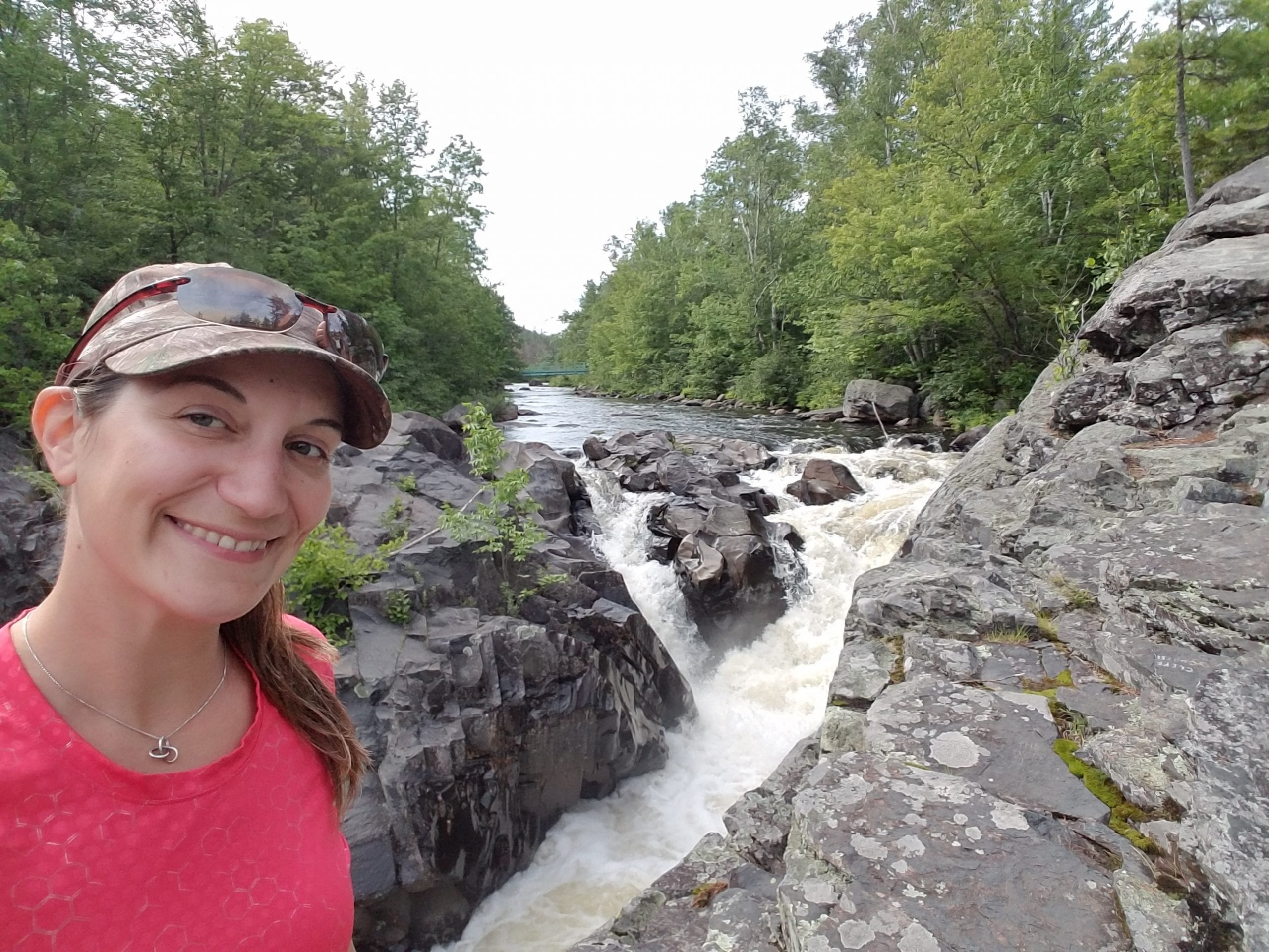
I recently visited the North Maine Woods to find two fantastic waterfalls: Gauntlet Falls and Mud Gauntlet Falls. Most people only visit Gauntlet Falls, but I noticed DeLorme shows Mud Gauntlet Falls just below Gauntlet and decided to check it out. I hear Gauntlet Falls is a popular swimming hole in the summer where people jump off the ledge into the stream below. I’m not that brave, but I did venture to the falls to get more information (and videos of course!).
How to Get To the Jo-Mary Road
Reaching the falls is very easy. The dirt road into the falls is Jo Mary Road, off Route 11 Between Millinocket and Brownville Junction. There is a nice sign that shows you where Jo Mary Road is, and not too far up the road is the Jo Mary Checkpoint. At the checkpoint, you will have to pay a use fee. Make sure you bring cash because they don’t take credit cards. Anyone under 15 and 70+ is free, while the rest of us pay $10/day/person for Maine residents and $15/day/person for everyone else.
Jo-Mary Lake Campground
While we didn’t check it out (although I wish we had), I hear the Jo-Mary Lake Campground is a fantastic spot to go camping. The folks at the checkpoint told me that there is a beautiful, long sand beach on Upper Jo-Mark Lake, and you have a perfect view of Mt. Katahdin which is just 22 miles away. Unfortunately, we found all this out on our way out. It’s on my list to check out next time!
If you decide to stay at the campground the fee structure is similar. Free for under 15 and 70+, Maine residents pay $12/night and all others pay $15/night. My next trip up in this neck of the woods will most likely involve a stay at the Jo-Mary Campground and some paddling on Upper Jo-Mary Lake.
The Drive from Jo-Mary Road
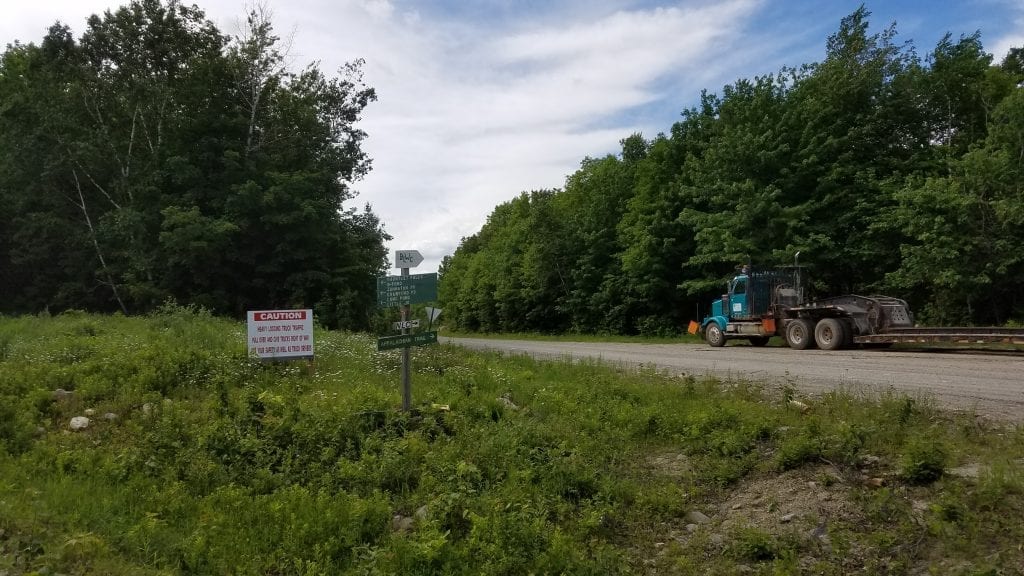
The drive to the falls from the Jo-Mary Road is very easy, and the road is a decent logging road. There are several logging operations that you will most likely pass by. Make sure you slow down in these areas, as skidders may be coming out of the woods.
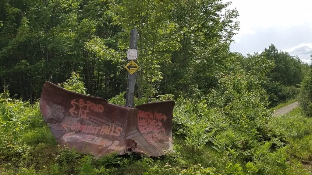
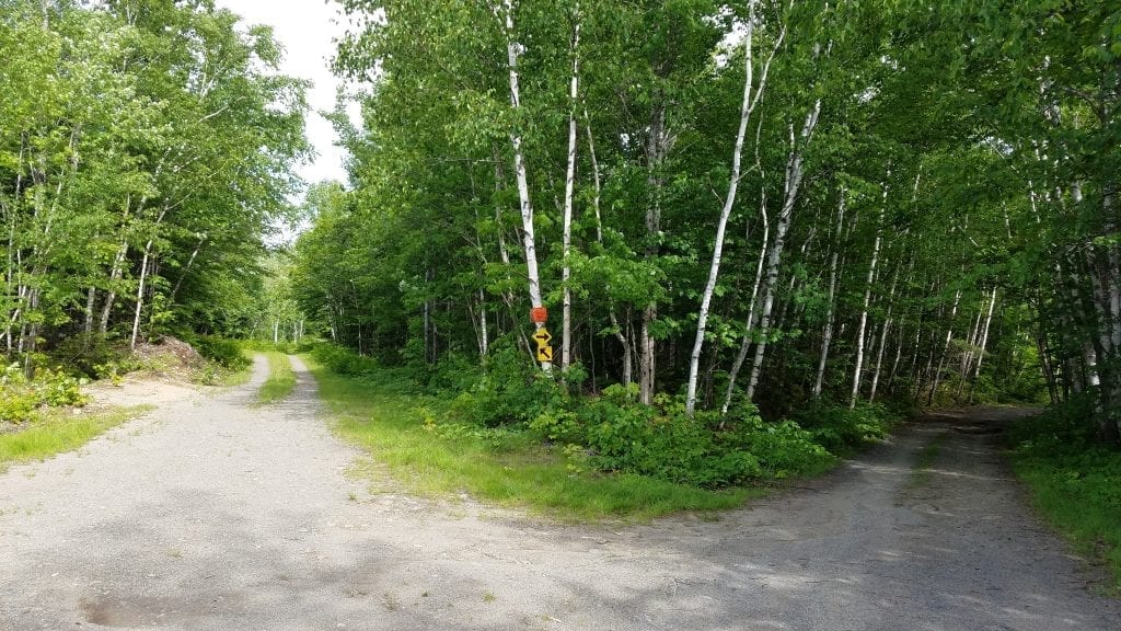
There are nice “signs” along the way that show you how to get to Gauntlet Falls, which is about 12.2 miles from the checkpoint. After about 6 miles you will reach a fork in the road. From the Jo-Mary Road continue on to the Johnson Pond Road at the fork for about 2.6 miles where you will reach another fork. Take the left onto B Pond Road and go another 3.5 miles until you reach the parking lot. The road divides a few times but it is clear which road is the main road, and there are signs showing you the way.
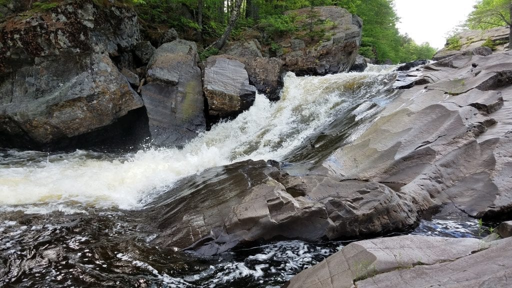
Gauntlet Falls
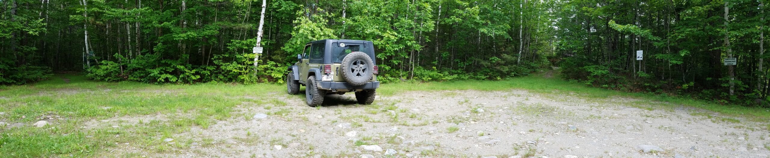
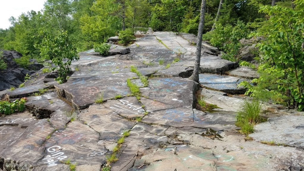

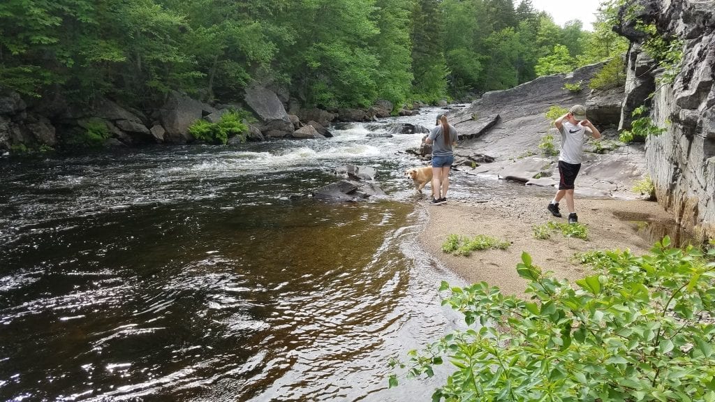
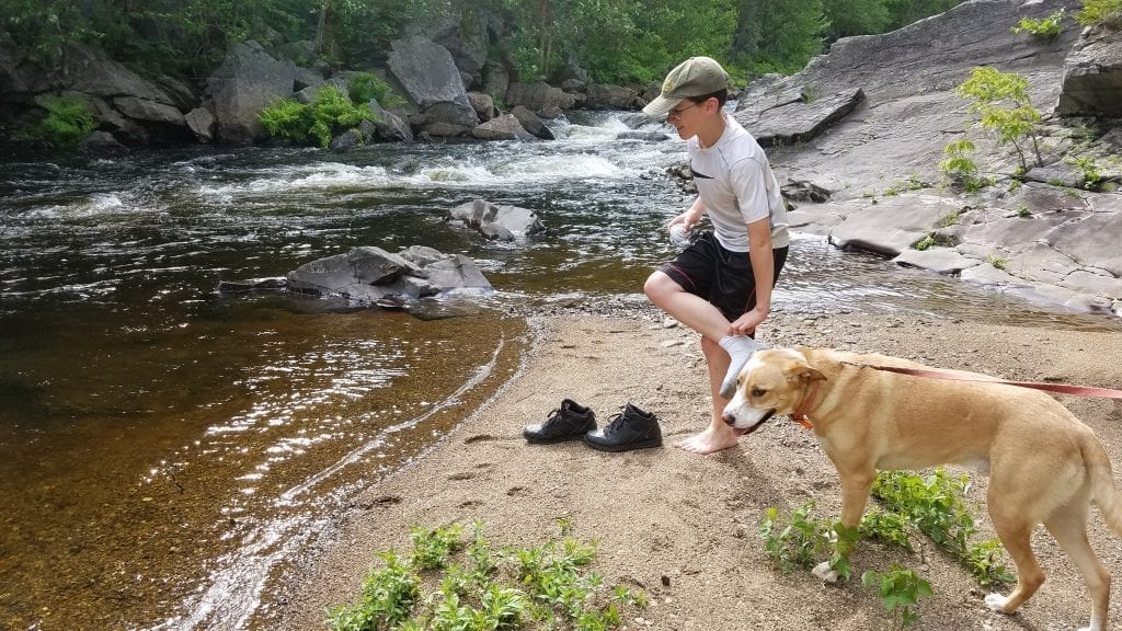
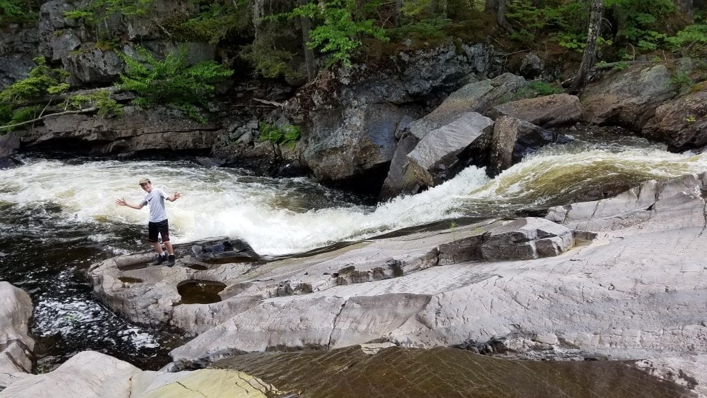
From the parking lot, you will see an outhouse off in the woods opposite the stream, and hear the roaring of the falls. There is a campsite just off the parking lot and several trails. You can take either trail- the one to the left of the campsite or the one located at 9:00 if you’re facing the direction of the stream which heads into the woods for a bit. The falls are located right at the parking area, so there really isn’t a “hike” in to get to Gauntlet Falls. The rock ledges are somewhat steep but have a nice slope to them. Dogs are allowed here on a leash, and small children should be kept close because the ledges and rocks are steep. Some people like to jump off the high ledges just below the falls and swim in the stream. Not this adventurer! I’m content with checking out the falls from the ledges.
But Wait, There’s More!
When we reached the checkpoint to sign in I asked the gatekeepers about Mud Gauntlet Falls. They had never heard of it in their 40 years of being in the area, and said no one had ever asked about it! I told them I would let them know what I found out, and if it was accessible when I came back through the checkpoint. From the DeLorme map, it was clear that Mud Gauntlet Falls is just a short ways down the river from Gauntlet Falls.
Heading Downstream
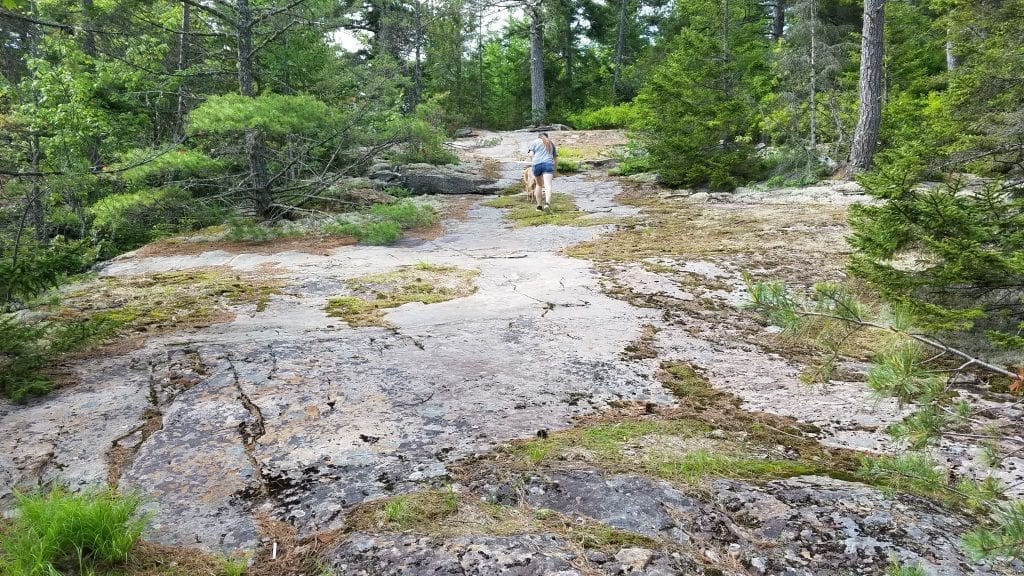
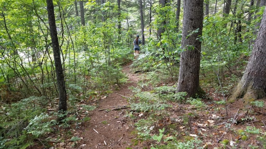
We decided to head back to the parking lot and check the map one more time before venturing down river. We took the path located at 9:00 (when facing the river) that looks like it goes into the woods a bit. That path leads you to another sloping ledge that goes towards the woods. When you get to the bottom of the ledge you will notice a small (one-person width) path that goes into the woods. The path is not marked and sometimes isn’t very clear with several other paths diverting from the main path. It is still fairly easy to follow- just stay on the path closest to the river.
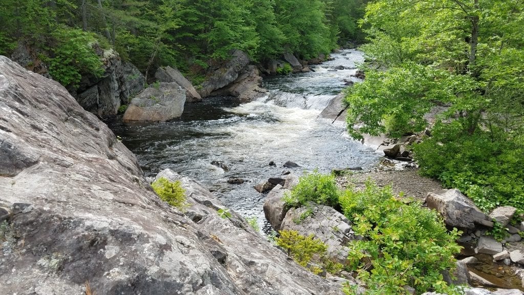
After a 5-7 minute walk, you will reach the larger falls. There are some smaller falls that you will walk past first before the larger waterfall. It is very clear that not as many people hike down the river, although it is well worth the extra few minutes!
Check out the Bridge
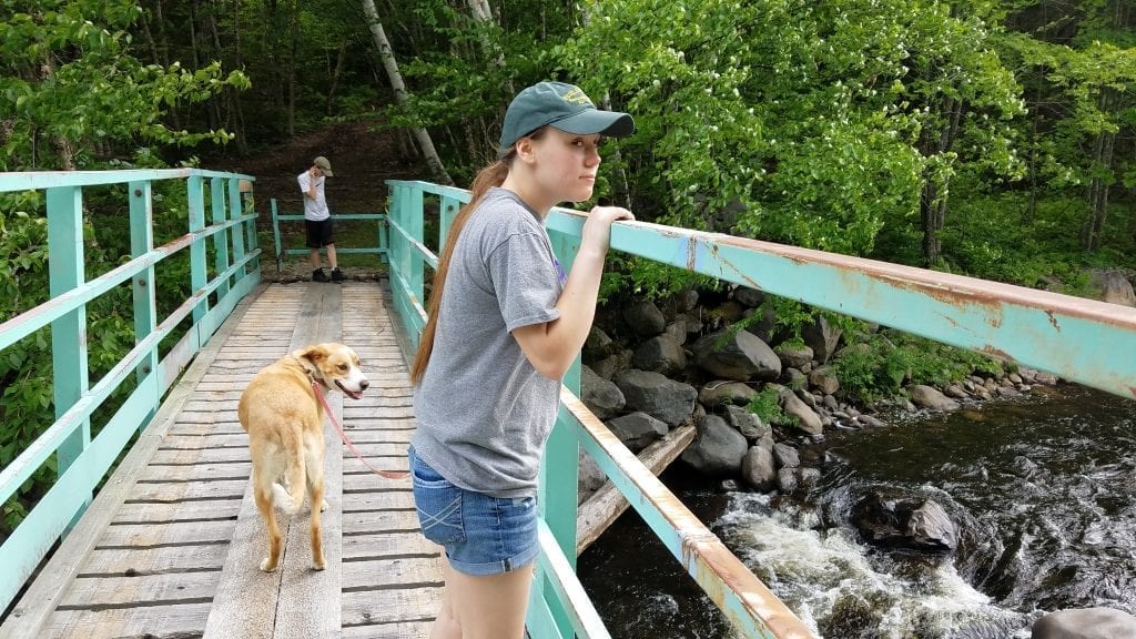
There is a snowmobile/ATV bridge just up the road from the parking lot. It’s within walking distance, and so we decided to check it out. Someone had built a campfire just before reaching the bridge and Aja noticed an incredible number of butterflies on the ground where the campfire had been and recorded them. We thought maybe whoever had the campfire was roasting marshmallows and lost a few in the fire, which the butterflies found. The bridge was interesting and didn’t offer any National Geographic-worthy views, but it was neat to check out and walk across.
Back to Jo-Mary Checkpoint
When we got back to the checkpoint I shared our experience and videos, including the gathering of the butterflies. One person who was in the office that works at the campground told us that he noticed butterflies like pee. He told us that he noticed when he answers nature’s call, a few hours later the butterflies are on the scene, checking things out. Maybe someone made sure the fire was out by peeing on it!?! I guess we’ll never know…!
“Almost” Only Counts In…
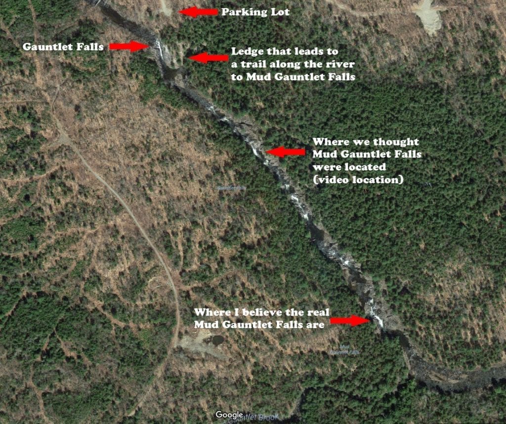
Upon further inspection (thanks to Google Maps with satellite imagery) I realized that we almost reached Mud Gauntlet Falls. Well, we didn’t reach the main waterfall anyway. I believe what we saw and what I recorded on video was what is considered another section of Gauntlet Falls.
It appears that, according to the map, the series of falls, from the first large falls to the smaller ones that follow, are considered Gauntlet Falls. The last large waterfall on this section of the river appears to be the one and only Mud Gauntlet Falls. I knew I should have checked the satellite image before we left! You know what that means? I see another Untamed Adventure in the near future! I’ll keep you posted! Let me know what you find if you make it there before I do!!!
Until next time, Stay Untamed!